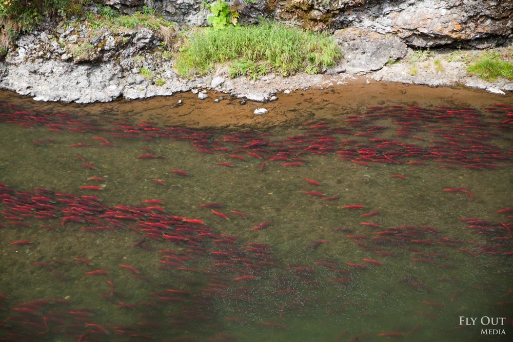
Photo by Fly Out Media
Bristol Bay Area Plan: History, Changes & What's Next
The State of Alaska owns about twelve million acres of land in the Bristol Bay drainages. In Alaska, Area Plans guide state land use decisions such as whether to allow development like the proposed Pebble mine on those state lands. Area plans were put in place to help ensure that State land management decisions achieve sustained use of renewable resources, keep a balance between development and environmental concerns, and protect public access and use to state land and its resources. State agencies take the plan into account when deciding whether or not to approve the use of specified areas of state lands for particular activities or development, and regulators take it into account when considering permits for activities or development that does occur.
The first area plan for Bristol Bay was adopted in 1984. It emphasized protecting fish and wildlife habitat, as well as hunting and fishing.
New ‘05 and ‘13 Area Plans: Major Changes to Management
In 2005 the Alaska Department of Natural Resources (DNR) revised the Bristol Bay Area Plan (BBAP). The 2005 plan was drastically different from the 1984 plan. It eliminated nearly all prior classifications of land for habitat and for hunting and fishing and classified land with mineral deposits as solely mineral land. This included the land at the Pebble deposit. Under this plan, mineral development like the proposed Pebble mine did not have to be compatible with habitat or public hunting and fishing, including subsistence.
Out of concern that the 2005 BBAP did not strike the right balance to protect subsistence and fish and wildlife, six Bristol Bay Tribes and commercial and sport fishing organizations sued the Alaska Department of Natural Resources over the 2005 BBAP changes. To settle this litigation, the State agreed to revise the 2005 Plan.
Subsequent litigation and settlement negotiations over the 2005 BBAP led DNR to propose and consider amendments to the plan, which were formally adopted in 2013. It was during the 2013 revision process that the people of Bristol Bay developed and published the Citizens’ Alternative BBAP (Citizens’ Alternative). In addition to technical recommendations on particular land use designations, the Citizens’ Alternative provided several important policy recommendations to ensure future area planning in the Bristol Bay region be done in a way that reflects the values, needs, and input of its people.
While the 2013 amendments to the BBAP were an improvement over the 2005 BBAP, those gains were incremental and we believe it is again appropriate for DNR to revise the existing BBAP to better reflect the needs and priorities of the people of the Bristol Bay region. Although we remain concerned with the current classifications of specific areas within the region, our primary goal is to discuss with you and your staff how better to incorporate the over-arching policy recommendations enumerated in the Citizen’s Alternative, including: creation and use of additional land use designations and classification categories; area-wide guidelines and management unit classifications that provide more protection for habitat and public uses; guaranteeing instream flow protection for fish; and reestablishing the Bristol Bay Advisory Group.
Our organizations are committed to ensuring that our region’s lands and waters are used in a way that benefits all Bristol Bay residents and Alaska as a whole. It is therefore critically important to us to have an area plan that reflects those values.
Download the preliminary DRAFT Citizens' Alternative Bristol Bay Area Plan (BBAP) (8.4 MB pdf)
The Citizens’ Alternative offers a better vision of the BBAP that is embraced by stakeholders. It rests upon these core principles:
1. The Citizens’ Alternative relies on science and better mapping to designate primary uses and improve public participation.
The Citizens’ Alternative contains GIS maps depicting essential and important habitat, and subsistence and sport hunting and fishing use areas, as reflected in data from ADF&G, DNR and other sources. In contrast, DNR’s 2005 BBAP did not contain a single map of any habitat type or subsistence or recreation use areas. DNR’s 2013 proposed amendments contain only one habitat map, and it is for moose. The lack of such maps departs from the previous 1984 BBAP, frustrates meaningful public participation, and leads to inconsistent results. For example, DNR proposes to designate some moose wintering areas as habitat, but not those near Pebble in the Upper Talarik Creek. Our reliance on maps avoids inconsistent, subjective judgments that lack foundation in the record and appear to be arbitrary.
Unlike DNR’s approach, the Citizens’ Alternative justifies each designated use and corresponding classification using maps to avoid confusion and fully inform the public. We hope DNR will adopt this approach. To do otherwise hinders management decisions and frustrates the public process.
2. The Citizens’ Alternative is consistent with the vision statement of the Bristol Bay Visioning Project and the history of state, federal, local and tribal efforts to balance conservation and development in the Bristol Bay drainages.
The Citizen’s Alternative is consistent with the vision statement adopted by the Bristol Bay Visioning Project. It was a multi-year project of the Bristol Bay Native Association, Bristol Bay Native Corporation, Bristol Bay Economic Development Corporation, Bristol Bay Housing Authority, and Bristol Bay Area Health Corporation. The vision statement seeks: to protect subsistence; to protect salmon, other fish, wildlife, waters and renewable resources; to protect and encourage a local economy based upon renewable resources; and to allow non-renewable resource development that doesn't threaten the above.
The Citizens’ Alternative is also consistent with past state, federal, local and tribal efforts to balance conservation and development in the Bristol Bay drainages and to conserve the Kvichak and Nushagak drainages in particular. In fact, DNR’s historical record makes it crystal clear that the State acquired the lands at the Pebble deposit, not by selection under the Statehood Act as it often claims, but by land exchange in order to protect fish.
See the BBAP Timeline for further detail
3. The Citizens’ Alternative improves area-wide management guidelines.
The Citizens’ Alternative significantly revises the area-wide guidelines to ensure that habitat, recreation, and subsistence are protected. Some of the revisions are:
an automatic instream flow protection for salmon
use of the “precautionary principle” when making any land use decisions that may significantly impact salmon
a presumption that all waters in the Bristol Bay region are anadromous
prohibition of metallic sulfide mining in the Nushagak and Kvichak watersheds
a new mineral closing order that would ban new mining claims on or along salmon spawning streams potentially threatened by mining
Header image by Fly Out Media


